
Every Seattle resident's share of parkland
355 sq ft
About the footprint of a small studio apartment
11.7% of Seattleites are within a 10-minute walk of a legal off-leash area (OLA). 76.6% are within SPR's published 2.5-mile OLA standard. This report measures the gap between "a park" and "a park where dogs are legal."
Seattle ranks among the top U.S. cities for park access: 99% of residents live within a 10-minute walk of a park, per TPL's 2025 rankings. Measured the same way, the off-leash system covers 11.7% of residents.
Trust for Public Land's access metric uses a half-mile walk along the street network, the distance most people will walk before driving. By that measure 99% of Seattle residents are within a 10-minute walk of a park. Applying the same measure to the 14 off-leash areas gives 11.7%, roughly 86,000 of the city's 738,000 residents in the 2020 Census. SPR's own OLA standard is 2.5 miles, about a 50-minute walk one way, and covers 76.6%. Both OLA figures are modeled here from Seattle's street network and Census block groups (method in Data notes).
The map shows the 14 existing OLAs with their half-mile walking areas, the two funded sites now expected in 2027 and 2028, and four sites in longer-term planning. The walk areas follow the pedestrian street network and stop at barriers such as I-5 and the Ship Canal. Even with all six built, central and north neighborhoods (Ravenna, Wallingford, Green Lake, Phinney, Maple Leaf) remain largely uncovered, and the closest legal OLA for most of Queen Anne and Magnolia stays Kinnear, at 0.124 acres.
Two independent checks point the same way. Enforcement: 71.9% of off-leash enforcement records placed at a geocoded park (2014–2026) fall outside any OLA's 10-minute walkshed, clustering in Capitol Hill, Queen Anne, Wallingford, Maple Leaf, and Ravenna; the analysis is on the Enforcement page. Equity: cross-tabbed against TPL's park-priority index, OLA coverage is highest in the top-priority tier (44%) and lowest in the middle tier (15%), where most of those hotspots sit (method in Data notes).
Access measures distance. A second measure is whether the acreage inside each ZIP matches the dogs registered there. Joining the ~26,700 active dog licenses (Seattle Open Data, April 2026) to OLA acreage by ZIP, and sizing each ZIP's fair share by its licensed dogs (about one acre per 800 dogs citywide), only four ZIPs sit above their share: Westcrest's (+7.3 ac), Magnuson's (+5.7), Dr. Jose Rizal and Blue Dog Pond's (+4.3), and Genesee's (+0.8). The deepest acre shortfalls are Fremont / Wallingford / Green Lake (98103), Capitol Hill / Central District (98122), Ballard (98107), Alki / Admiral (98116), and the U District (98105); the last four have no OLA acreage at all. Queen Anne (98119) and South Lake Union (98109) rank tenth and twelfth by acres short, but first and second by dogs per OLA acre, because each has a single OLA of roughly a tenth of an acre.
827 licensed dogs. Denny Park's OLA: 0.105 acres, 4,574 sq ft, roughly one basketball court for the neighborhood.
870 licensed dogs. Kinnear OLA: 0.124 acres, 5,401 sq ft, about one basketball court for the neighborhood.
Licensed-dog counts are floors: most Seattle dogs are unlicensed, so the deficits above understate demand. ZIPs are the finest geography the license dataset provides and don't map cleanly to neighborhoods; labels lead with a primary neighborhood and cite the ZIP. ZIPs that extend past the city line are excluded from the fair-share calculation because OLA acreage is Seattle-only.
"14 OLAs" is the headline count. Half are under one acre and three are under a quarter-acre; the four largest hold ~79% of the total.
The median Seattle OLA is under one acre. The two smallest, Denny at 0.105 acres and Kinnear at 0.124, are each roughly the footprint of a basketball court. The bottom seven together hold under 10% of the city's ~31 OLA acres.
Divide Seattle's parkland by its people, and its OLA footprint by its dogs, and draw both at the same scale.
A Seattle resident has roughly 66× more parkland per person than a Seattle dog has dedicated off-leash space per dog. At the conservative 150,000-dog floor the ratio is 40×. Dogs are allowed in Seattle parks on leash; the comparison is off-leash space only, and 99.5% of the city's parkland is off-limits to off-leash dogs.
What the 14 OLAs offer beyond a fence. The water figure is the City's own; the lighting figure comes from a 2021 user survey and has not been confirmed by SPR.
Three independent authorities publish overlapping standards for the size of a functioning neighborhood dog park and the per-dog capacity a park of a given size can support.
Applied to Seattle: seven of 14 OLAs are below the AKC 1-acre floor, and three are below a quarter-acre. At 100 sq ft per dog, Kinnear (~5,400 sq ft) implies a peak of about 54 dogs and Denny (~4,600 sq ft) about 46. SPR signage at Kinnear asks owners with more than three dogs to use another OLA. Kinnear is the closest designated OLA for most of Queen Anne, though most of the hill lies outside its 10-minute walkshed.
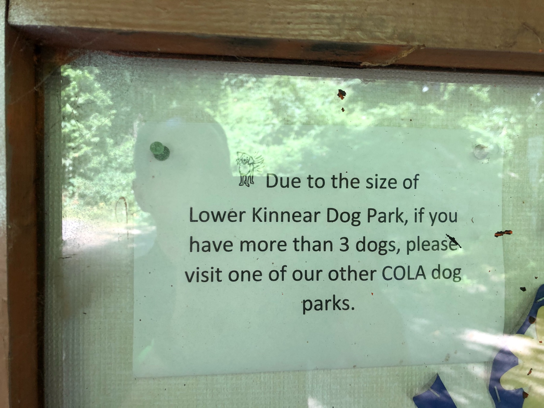 Park signage asking 3+-dog owners to use another OLA.
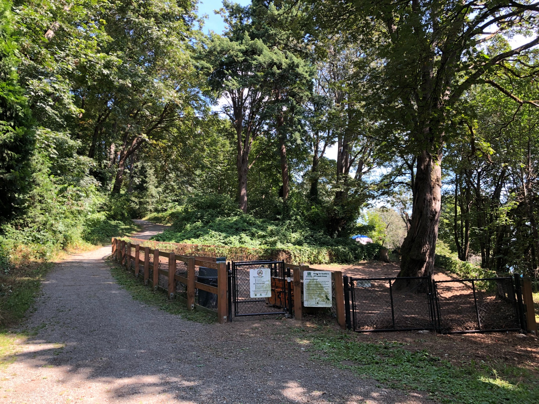 Park entrance, July 2019. Encampment tarp visible (intermittent).
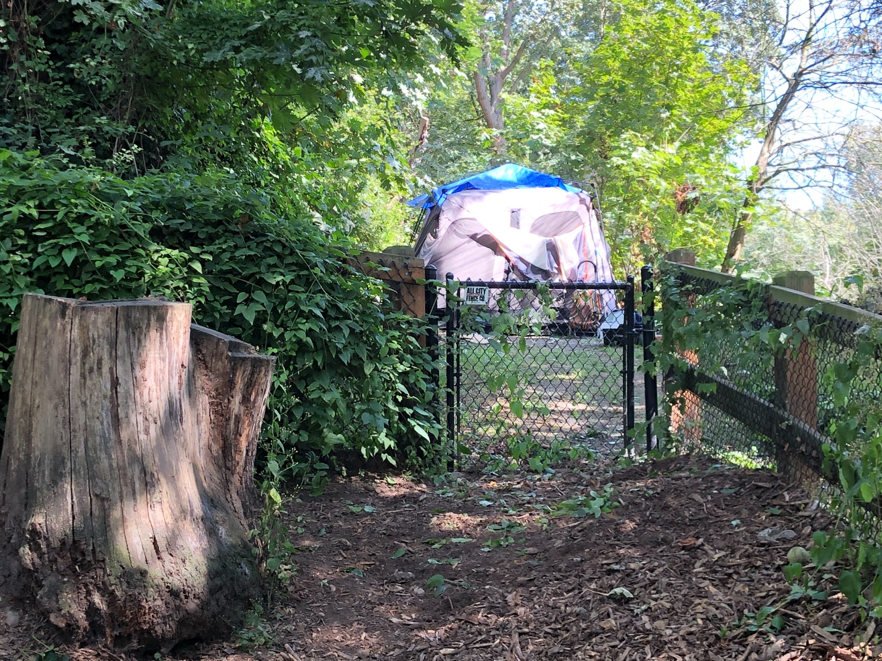 Tent against the OLA's back fence (July 2019); intermittent.
Comparing OLA acreage across cities is harder than comparing counts, because cities define "off-leash" differently: Portland's 38 sites are mostly unfenced voice-control areas, San Francisco's 42 include small dog play areas inside larger parks, Vancouver BC's 36 include time-restricted beaches and fields, and Seattle counts only dedicated sites (12 fully fenced, two partially). On a best-effort, methodology-adjusted basis Seattle sits at the bottom of the five-city set: Vancouver BC has about 6.7× Seattle's OLA acreage per resident, San Francisco 3.6×, Portland 3.4×. The per-city detail, governance, and funding models are on the Peer Cities page; the adjustments are in Data notes.
Three sources bear on the scale of illegal off-leash use: SPR's 2015 owner survey, Find-It-Fix-It complaints, and the City's own enforcement agency, which told the Council in 2022 why it happens.
In 2015, as part of the research behind the People, Dogs and Parks Plan, SPR surveyed 3,970 dog owners; about 38% admitted illegal off-leash use, a self-reported figure given to the enforcing agency and likely an undercount. Residents now file about 3,000 “Nuisance Dogs in a Park” complaints a year. The complaint category was only created in 2024, so there is no longer trend to read; the Enforcement page sets complaint volume against enforcement output over the overlapping months.
“The lack of available Off Leash Areas could encourage pet owners to take their dogs off leash in regular City parks where other park users are affected.” … “Dog owners consistently share with SAS that OLAs aren't within walking distance and are overcrowded.” — FAS response to Council Statement of Legislative Intent FAS-003-B-001 (PRR C266465, Bates 00524)
That is the City's enforcement agency stating the supply explanation, not this site inferring it. The same report told Council that "achieving compliance … requires a holistic approach, involving enforcement, an increase in Off Leash Areas and more robust educational campaigns," and that without a legal option nearby, owners weigh a 25-minute drive against the park down the street. The enforcement records show the result: contacts concentrate in neighborhoods without a nearby OLA, or where the OLA that exists is a tenth of an acre.
Kinnear's OLA is at the far side of Lower Kinnear Park from the parking lot and main entrance. The park has been the site of documented encampment activity and clearance cycles for over 20 years; the record is in kinnear-timeline.csv.
Implications for access counts. Kinnear is counted as Queen Anne's OLA in SPR's gap analysis. Many Queen Anne dog owners drive to Magnuson or Magnolia Manor instead, or use Kerry Park, Rodgers Park, Queen Anne Bowl, or nearby school playfields, where off-leash use is not authorized. Plymouth Pillars (Capitol Hill), Denny Park (SLU), and Regrade (Belltown) sit in or adjacent to similar site-safety patterns. The nominal count of 14 assumes all 14 are practically functional for their neighborhoods.
Sources, methodology and caveats for this page: Data & Methods.
